Skip to content
MotoAtlasMotoAtlasMotoAtlasMotoAtlas
two_wheelerToursterrainRoutes
routePlan your ridearrow_forwardperson
MotoAtlas

Routes for riders who'd rather take the long way. Surveyed, ridden and written up for touring and dual-sport travel.

  • explore
  • two_wheeler
  • terrain
  • public

Tour categories

  • Alpine high passes
  • Desert & dune crossings
  • Backcountry discovery
  • Coastal fjord traverses
  • Guided dual-sport

Expedition resources

  • Trans-Alpine GPX (demo)
  • Carnet & border crossing prep
  • Technical tire & luggage specs
  • Satellite SOS & wayfinding
  • Safety protocols & evacuation

© 2026 MotoAtlas Expedition Technologies. All rights reserved.

  • Terms of service
  • Privacy policy
  • Route safety disclaimer
Skip to content
MotoAtlasMotoAtlasMotoAtlasMotoAtlas
two_wheelerToursterrainRoutes
routePlan your ridearrow_forwardperson
MotoAtlas

Routes for riders who'd rather take the long way. Surveyed, ridden and written up for touring and dual-sport travel.

  • explore
  • two_wheeler
  • terrain
  • public

Tour categories

  • Alpine high passes
  • Desert & dune crossings
  • Backcountry discovery
  • Coastal fjord traverses
  • Guided dual-sport

Expedition resources

  • Trans-Alpine GPX (demo)
  • Carnet & border crossing prep
  • Technical tire & luggage specs
  • Satellite SOS & wayfinding
  • Safety protocols & evacuation

© 2026 MotoAtlas Expedition Technologies. All rights reserved.

  • Terms of service
  • Privacy policy
  • Route safety disclaimer
Skip to content
MotoAtlasMotoAtlasMotoAtlasMotoAtlas
two_wheelerToursterrainRoutes
routePlan your ridearrow_forwardperson
MotoAtlas

Routes for riders who'd rather take the long way. Surveyed, ridden and written up for touring and dual-sport travel.

  • explore
  • two_wheeler
  • terrain
  • public

Tour categories

  • Alpine high passes
  • Desert & dune crossings
  • Backcountry discovery
  • Coastal fjord traverses
  • Guided dual-sport

Expedition resources

  • Trans-Alpine GPX (demo)
  • Carnet & border crossing prep
  • Technical tire & luggage specs
  • Satellite SOS & wayfinding
  • Safety protocols & evacuation

© 2026 MotoAtlas Expedition Technologies. All rights reserved.

  • Terms of service
  • Privacy policy
  • Route safety disclaimer
Skip to content
MotoAtlasMotoAtlasMotoAtlasMotoAtlas
two_wheelerToursterrainRoutes
routePlan your ridearrow_forwardperson
placeHomechevron_rightTourschevron_rightEuropean Alpschevron_rightWestern Alps
Classic gravel

Western Alps

Military high roads

placeEuropean AlpsplaceMilitary high roads
routeLogLog this ride

Log this ride

Optional, 280 characters. Only you can read it.

Add a field note on this route to verify the stamp.

pendingGPX in survey
calendar_today

Duration

7 days

6 nights

route

Distance

1,420 km

~200 km/day avg

landscape

Terrain

Classic gravel

European Alps

star

Satisfaction

4.60 / 5

89 rider reviews
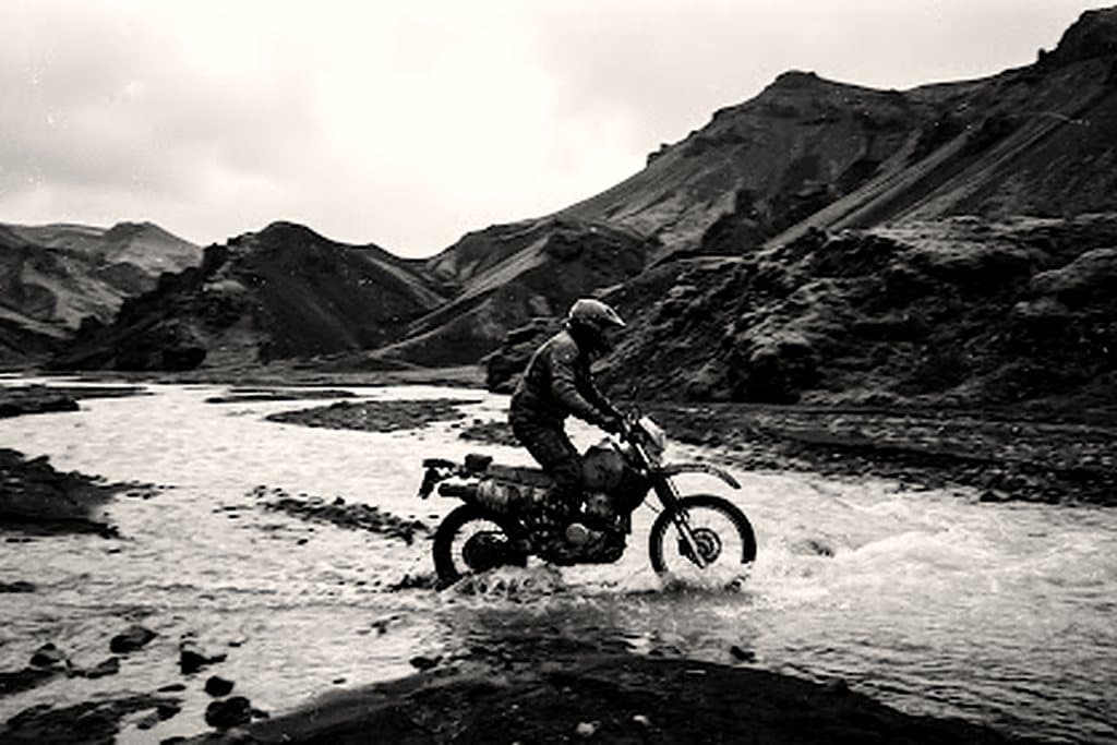
Western Alps approach
Route preview
OverviewDay-by-dayBike & gearEssentialsRider notes
arrow_backBack

Route overview

Route overview

Via del Sale, Assietta ridge and Colle delle Finestre along historic high-altitude fortress roads.

7 days and 1,420 km of classic gravel through European Alps, averaging 200 km a day. Fuel gaps, lodging waypoints and evacuation distances are surveyed stage by stage.

sensors

Surveyed telemetry

GPX tracks, fuel gaps and lodging waypoints for all 1,420 km.

health_and_safety

Evacuation cover

Satellite SOS coverage mapped per stage, with nearest clinic distances documented.

Route log

Day by day

terrain+4,260 m cumulative · 11.4% steepest

  1. 1

    Arrival & machine check

    routeEuropean Alps gateway · 280 km

    Fleet handover, luggage fitting and a shakedown loop before the route leaves European Alps.

  2. 3

    Opening sector

    routeMilitary high roads stage 2 · 280 km

    Roughly 280 km of classic gravel, with fuel and lodging waypoints at both ends of the stage.

  3. 4

    Mid-route pass

    routeMilitary high roads stage 3 · 280 km

    Roughly 280 km of classic gravel, with fuel and lodging waypoints at both ends of the stage.

  4. 6

    Remote refuel & wild camp

    routeMilitary high roads stage 4 · 280 km

    Roughly 280 km of classic gravel, with fuel and lodging waypoints at both ends of the stage.

  5. 7

    Final approach & finish

    routeMilitary high roads stage 5 · 280 km

    Roughly 280 km of classic gravel, with fuel and lodging waypoints at both ends of the stage.

Field kit

Motorcycle fleet & riding kit

  • two_wheelerBMW R 1250 GS

    Tubeless spoked rims, heavy-duty crash bars, Heidenau K60 Scout knobbies.

  • two_wheelerYamaha Ténéré 700

    Rally-biased off-road setup with long-travel KYB suspension and aluminium skid plate.

  • two_wheelerKTM 890 Adventure R

    WP XPLOR suspension for aggressive gravel, low-slung tanks for stability.

Recommended equipment

  • Tubeless spoked wheels
  • Heated grips
  • Auxiliary lighting
  • 12V USB-C charging

Mandatory rider kit

  • ECE 22.06 helmet
  • Certified back protector
  • Waterproof gloves + liners
  • Sturdy boots

Field dispatches

Rider notes

0 notes · Every note is reviewed before publishing.

loginSign in to comment

No approved notes on this route yet. Be the first to leave conditions, fuel gaps or a warning.

Route intel

Route telemetry dispatch

Self-guided

Seasonal windows

  • PrimePrime
  • ShoulderShoulder
  • Off seasonClosed

fact_checkRoute checklist

  • checkInternational driving permit
  • checkTravel insurance with evacuation
  • checkOffline GPX plus paper map
  • checkTyre repair kit and spare tubes
  • checkSatellite messenger with tracking
MotoAtlas

Routes for riders who'd rather take the long way. Surveyed, ridden and written up for touring and dual-sport travel.

  • explore
  • two_wheeler
  • terrain
  • public

Tour categories

  • Alpine high passes
  • Desert & dune crossings
  • Backcountry discovery
  • Coastal fjord traverses
  • Guided dual-sport

Expedition resources

  • Trans-Alpine GPX (demo)
  • Carnet & border crossing prep
  • Technical tire & luggage specs
  • Satellite SOS & wayfinding
  • Safety protocols & evacuation

Waypoint dispatches

New routes, open passes and road intel, once a week.

mail

© 2026 MotoAtlas Expedition Technologies. All rights reserved.

  • Terms of service
  • Privacy policy
  • Route safety disclaimer